The technology used for satellite imagery is widely available and accurate, and farmers can benefit from it, say Tony Palmer and Alan Short of the Agricultural Research Council’s Animal Production Institute (ARC-API).
Once the technique of converting satellite data into an accurate picture of plant growth (and so of grazing capacity) is refined, researchers can give farmers real-time plant-production estimates for their veld. This will be invaluable for fodder-flow planning in livestock areas.
Regional maps will be available from the agriculture department’s Agricultural Geo-referenced Information System (AGIS) at www.agis.agric.za. These maps will help government support farmers during exceptional circumstances, such as droughts.
By measuring surface temperature and atmospheric and soil moisture, satellite-borne sensors can show when conditions are optimal for evapotranspiration (ET), and so for plant growth (see box: Plain speaking: ET & water-use efficiency).
Launched in the late 1990s, the Moderate Resolution Imaging Spectroradiometer (MODIS) was designed to give improved ET estimates. The sensor collects data to calculate a normalised difference vegetation index, which is a daily estimate of plants’ active growth. Cloud-free images are then used to prepare an eight-day summary of the leaf-area index, which is the leaf area from which ET can occur.
Correlation between MODIS and ET
Working with researchers from the University of Technology, Sydney, Tony has shown that there’s a correlation between the MODIS leaf-area index and daily ET estimates from instruments that measure ET on the ground in Australia’s woodland and savannah systems.
“In these summer rainfall ecosystems, ET is greatest in the warm wet season in spring, early summer and autumn, but declines in very hot conditions in mid-summer when plants close their stomata to conserve moisture,” he says. “There’s also very little actual ET taking place in the cool dry season as the soil store has been depleted.”
This relationship between MODIS leaf-area index and actual ET can also predict biomass production in the South African savannah. As South Africa also produces livestock on grassland, succulent Karoo, Nama-karoo and thicket biomes, the water-use efficiency of typical veld conditions in these biomes will be researched as part of a project funded by the ARC, the National Research Foundation and Red Meat Research Development South Africa.
In grassland ecosystems, ET patterns are simpler than in woodlands. To show the process, Tony and Alan plotted a graph of plant growth from Kokstad in the Highland Sourveld. Figure 1A shows seasonal trends in actual ET, with high values in the warm wet season (about 4mm/day), and a decline in ET in cool winter months (0,6mm/day). During the very wet weather in January 2006, ET dropped.
So, although there was ample soil moisture, the lack of sunshine reduced the energy available to drive ET. This shows how MODIS adjusts for such changes and helps provide a realistic picture of actual ET and production efficiency. Figure 1B shows grass production for the same period, the ratio between production and ET being the water-use efficiency.
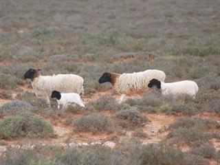
In the succulent Karoo (Richtersveld and Namaqualand) seen in Figures 2A and 2B, production is driven by cool wet season rainfall or fog. There’s abundant sunshine in summer, but no soil moisture. Active green growth occurs in the cool wet season and even in a very good rainfall year like 2007, production is far lower than in the grassland biome due to lower rainfall and lower water-use efficiency of the ecosystem’s succulent shrubs.
The succulent karoo is less water efficient than the grassland biome – the norm is water-use efficiency values between 5kg to 6kg dry matter per millimetre of ET, as opposed to the 7kg to 8kg dry matter for grassland. Bearing in mind that these water use efficiency values are based on ET, they should not be confused with those based on annual rainfall which are used by some farmers.
The two extreme situations in Kokstad and Richtersveld are good examples of how carrying capacity predictions must be based on accurate estimates of plant production.
Contact Tony Palmer on 046 622 2638.
Sources: Palmer AR, Short A, and Yunusa IAM. 2010. Biomass production and water use efficiency of grassland in the Kwa-Zulu Natal, South Africa. African Journal of Range and Forage Science. Submitted July 2010; Palmer AR, Konje MM, and Yunusa IAM. 2010. Biomass production and water use efficiency of arid rangelands in the Richtersveld, Northern Cape, South Africa. Journal of Arid Environments. Submitted July 2010.

