

Farmers in the high-rainfall areas of South Africa, on the Highveld and in the high-altitude areas of the Eastern Cape and KwaZulu-Natal (KZN), need rain now to produce enough grass to carry them through the cold winter season.
Dr Louis du Pisani, an independent agricultural consultant, told Farmer’s Weekly that conditions in this region were on a knife’s edge, and sufficient rain up until the start of January could make the difference between a good or very challenging season for livestock farmers.
By February, however, the rain will be too late as cooler temperatures the rest of the season will have a negative effect on growth.
“I am hoping for about 200mm to 300mm of rain soon in these regions. Many of the farmers in these regions do not have any drought backup plans, like some farmers in the drier parts of the country, because they are used to getting a lot of rain,” he said.
He added that the arid and semi-arid parts of the country had a little more time for the rain to set in.
“At this point in time it is difficult to give anybody advice on how to prepare for the season, as things can go 50-50. I would say the best thing to do is to wait until the first of January in the high rainfall-areas. Farmers in the arid and semi-arid regions might have a month longer if they have feed reserves left from the previous season.”
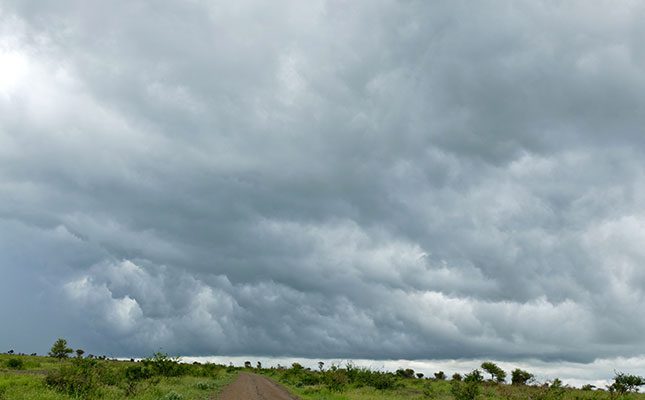
Johan van den Berg, an independent agricultural meteorologist, told Farmer’s Weekly that it looked as if the weather was turning in the high-rainfall regions. It had started raining in Mpumalanga a week ago, with light rain also being received in the Eastern Free State.
Along with this, the South African Weather Service (SAWS) forecasts a significant improvement in rainfall over the coming week in the eastern provinces, with models predicting 70-150mm of rain in parts of Gauteng, Mpumalanga, KZN, the eastern part of the North West and the western and southern areas of Limpopo.
Large parts of South Africa’s interior have experienced heatwaves in recent months, with a particularly intense and prolonged heatwave lasting for two weeks during the first half of December. This resulted in several new temperature records, both maximum and minimum, across various provinces.
In addition to the extreme heat, the central and eastern interior of the country has seen substantially less rainfall this season, contributing to drought-like conditions and low catchment water levels. SAWS, unfortunately, expects the dry trend to continue over the central interior for the next week, with only isolated thunderstorms possible.
Van den Berg said he was especially concerned about parts of the Northern Cape, which had not received substantial rain for the past two seasons. It looks as if the Northern Cape might receive a little precipitation over the short term, but unfortunately this will not be enough to break the dry conditions.
However, lucerne and table-grape farmers in the region who have access to sufficient irrigation water look as if they might have a promising season.
“In the past week we have seen the El Niño-Southern Oscillation (ENSO) entering La Niña state values. The length and strength of the La Niña event is still debatable, with early indications pointing to a weak La Niña.
“Entering a La Niña state now, however, bodes well for the second half of the summer rainfall season, from mid-January to March.”
In its Climate Seasonal Watch, SAWS predicted above-normal rainfall for the north-eastern central and coastal areas and below-normal rainfall for most parts of the summer rainfall area from December to April.
Minimum and maximum temperatures are expected to be mostly above-normal countrywide for the period forecast. However, below-normal temperatures are likely throughout the summer period in the southern coastal areas.
SAWS expects a weak La Niña state to develop during midsummer, which may only affect South Africa’s summer rainfall during the latter parts of the season.
The World Meteorological Organization (WMO) said recently that there was a 55% likelihood of a transition from current neutral conditions to Na Niña conditions from December to February, with a return to an ENSO-neutral conditions favoured from February to April.
WMO secretary general Celeste Saulo said that 2024 started out with El Niño and was on track to be the hottest year on record: “Even if La Niña emerges, its short-term cooling impact will be insufficient to counterbalance the warming effect of record heat-trapping greenhouse gases in the atmosphere.”
Saulo added that even in the absence of El Niño or La Niña conditions experienced since May, the world had witnessed an extraordinary series of extreme weather events, including record-breaking rainfall and flooding, which had become the new norm in our changing climate.


