

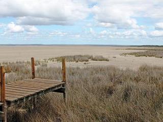
Before the 1950s, a visitor to Lake St Lucia in Kwa-Zulu Natal had a clear view from the north bank of the mouth of the lake to Maphelane, 3km to the south. In this panorama was a vast expanse of water, much of which came from the uMfolozi River.
The inflow was just inland of the beach.
The uMfolozi’s fresh water made a vital contribution to the health of the 70km- to 90km-long, saline Lake St Lucia system. Then, in the 1950s the decision was made to separate river from estuary and the functioning of the entire system began to change. This was primarily due to the well-meant but ultimately destructive efforts of conservation managers at the time, who thought they were doing what was best for Africa’s largest estuarine system of 36 000ha.
During the subsequent decades, management strategies did not change to any significant degree. According to a statement
by the iSimangaliso Wetland Park Authority, which has managed the 332 000ha park since its declaration as a UNESCO World Heritage Site in December 1999, early conservationists were concerned about possible negative impacts of the uMfolozi’s high silt loads on the Lake St Lucia estuary.
“This was a consequence of the canalisation of the uMfolozi River by upstream sugarcane farmers and the resultant abnormally functioning floodplain. Measures were taken to partially separate the uMfolozi River from the Lake St Lucia estuary in the early 1950s by depositing dredge spoil between the river and the estuary to prevent silt from being carried into the Lake St Lucia system. The uMfolozi River mouth was also artificially breached into the sea near Maphelane,” the park authority explains.
At one stage, up to six dredgers were used simultaneously to dredge large parts of the estuary – up to 20km from the mouth – in the belief that removing this silt would help the ecosystem to function better.
Hundreds of thousands of cubic metres of this dredge spoil was then dumped between the estuary and the uMfolozi River mouth to keep the two apart. The artificial barrier is now 90ha in area and up to 12m above mean sea level. The previously unobstructed view of Maphelane became a thing of the past.

Some of the role players involved in linking up the uMfolozi River and the Lake St Lucia estuary are (from left): Gerrit van Ryssen (engineering manager: Cyclone Engineering Projects), Andrew Zaloumis (CEO: iSimangaliso Wetland Park Authority), Bronwyn James (manager: iSimangaliso’s Global Environment Facility-funded project), and, Nicky Forbes ( managing director: Marine & Estuarine Research).
A new view
Present-day managers have access to vastly improved technology and increasingly refined ecosystem management research resources. Sophisticated models make scenario prediction possible.
iSimangaliso CEO, Andrew Zaloumis, is passionate about getting the estuary functioning as naturally as possible once more. He explains that during the extensive dry period experienced in the park between 2002 and 2012, the management approach of trying to keep the uMfolozi River and the Lake St Lucia estuary apart was called into question.
“The impact of starving Lake St Lucia of the uMfolozi River’s freshwater was brought into stark relief. High salt levels in the Lake St Lucia system caused some species to go extinct,” Andrew explains.
The Tugela Bank prawn fishery collapsed and other fisheries suffered heavy losses. Natural resources available for subsistence use decreased significantly and tourism was negatively affected. Before it was deliberately separated from the Lake St Lucia estuary, the uMfolozi River provided 60% of Lake St Lucia’s freshwater needs. The remaining 40% came
from the uMkuze, Mzinene, Hluhluwe and Nyalazi rivers that also feed into the system, but much farther north than the uMfolozi. The lake system was effectively functioning on 40% of its original freshwater supply.
Adding to pressure on the now sub-optimally functioning Lake St Lucia system were the needs of about 80 000 people in 15 000 households, living within 15km of the system. Many of these people depend on the sustainable harvest and utilisation of a variety of natural resources, valued at about R7,5 million annually, from the Lake St Lucia system.
Tourism – a key factor
Tourism is a major income generator for people living around, and working in, iSimangaliso. “Tourism related to the Lake St Lucia estuary provides 1 291 direct full-time equivalent jobs and 6 924 indirect jobs,” Andrew points out. “There are roughly 510 000 visitors to the area every year, of which 42% are foreign. The foreigners spend R46 million on an estimated 157 000 tourism activities created by local operators.”
Restoring some function to the Lake St Lucia system for the benefit of its animals, plants and people became a key focus for the iSimangaliso Wetland Park Authority. Andrew and his team commissioned a comprehensive five- year study to see what action they could take to reach this goal in the best possible way. Top international and South African environmental management experts were contracted to conduct a large number of studies for this purpose.
According to Bronwyn James, the research and its associated goals were considered to be so important that the iSimangaliso Wetland Park Authority was able to obtain a US$9 million (R148 million) grant from the Global Environment Facility (GEF). This made a significant contribution to paying for the research. The GEF, a partnership of 183 countries, international institutions, civil society organisations and the private sector, exists to address global environmental issues.
Bronwyn, manager of the GEF-funded project in iSimangaliso, says that the new research “debunked the myth that silting and sediments were a problem for the Lake St Lucia system”.
Silt, she explains, is an important component of the estuary benthos. These life-giving organisms inhabit the bed of the estuary and provide nutrition for plants, fish, and other animal species.
The research concluded that the uMfolozi River, which had been actively managed out of the Lake St Lucia system up to 2006, is a significant contributor of freshwater to the St Lucia estuary and, importantly, is the powerhouse that drives the mouth dynamics.
Based on the results of the GEF-funded research, it was decided to leave nature to its own devices. The uMfolozi River was to be allowed to pursue its natural path northwards and flow into the St Lucia estuary. The river would once again contribute 60% of the lake’s freshwater needs.
The first direct intervention towards achieving this was the establishment in 2012 of a temporary spillway between the uMfolozi River and the Lake St Lucia estuary. This entailed removing a relatively small quantity of dredge spoil so that the uMfolozi could flow into the estuary along its natural course. The joining of the two water bodies via a single mouth into the sea was not done at this stage.
Fundraising
Nicky Forbes, managing director of Marine and Estuarine Research, a company contracted to conduct GEF-funded research, says that the next step is to gradually remove the barrier of dredge spoil that has kept the uMfolozi and the Lake St Lucia estuary apart for more than 60 years. According to him, the R30 million secured so far is enough to remove about a third of the barrier.
The iSimangaliso Wetland Park Authority is hard at work fundraising for the balance of the money needed to remove the entire barrier.
“It was calculated that, with the money currently available, the best value for money would be to remove the barrier starting from a point nearest to the ocean. The first tender, valued at R10 million, has been awarded to Cyclone Engineering Projects (CEP) for the removal of nearly 97 000m3 of dredge spoil,” says Nicky.
Water-blasting the barrier
To remove the spoil, CEP will use high-powered water cannons to fluidise the dredge spoil into slurry. This will be pumped into the Indian Ocean via a long hose. To prevent the build-up of dredge spoil off the beach, the outlet of the hose into the ocean will be moved regularly. The ocean currents off the coastline will do the rest.
“While this will represent short-term sediment enrichment to the coast, over the longer term this is well within the normal volumes of sand moving along the shoreline,” Nicki explains. “The volume of sand to be disposed of into the sea through this intervention is less than 5% of the annual sediment yield from the uMfolozi River that carries large volumes of sand during high flow and flood events.”
As funds allow, the removal of the dredge spoil barrier will continue until it is completely gone. This will take some years. However, the uMfolozi River and Lake St Lucia estuary will have joined again – albeit partially – long before the barrier is eliminated.
Contact iSimangaliso Wetland Park Authority on 035 590 1633 or at [email protected]. Visit isimangaliso.com.


